_edited.jpg)
Drone Surveys
As construction industry specialists with over 25 years experience, our team of fully qualified and proficient drone pilots deliver survey-quality photogrammetry & infrastructure inspections.
We have extensive experience in carrying out a single small inspection through to managing nationwide on-going and annual inspections of strategic national infrastructure.
FASTER & SAFER INSPECTIONS
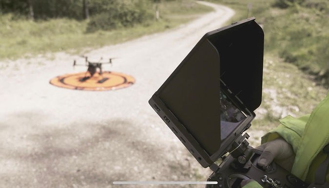
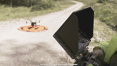
Our remotely operated drone, mounted with a high definition camera, allows us to inspect, record and monitor your infrastructure in a fast and safe way.
Safely reach areas that traditional ground-based equipment can't!
HOW WE CAN HELP
Our remotely operated drone, mounted with high definition cameras and required payloads, allows us to inspect, record and monitor your infrastructure in a fast and safe way.
-
Evidence images - we can produce photographic evidence to substantiate a potential claim. Footage can be recorded either during or after an incident.
-
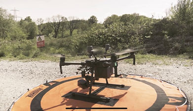
Our drones - we use a DJI Matrice RTK. This is the ultimate aerial tool, built specifically for industrial inspections and using the latest industry-leading software.
-
Our camera - is a DJI Zenmuse camera (from the Z30 with a 30x optical zoom to the X5S)
– fantastic for creating film.
We also have additional technology to help us better support clients in the Architecture, Engineering & Construction (AEC) industry and Renewable Energy Industry:
-
Thermal cameras - which can be used to carry out comprehensive surveys of solar farms.
OUR EQUIPMENT
We use the very best equipment to ensure you get the most detailed, accurate and trustworthy results from your inspection or survey:
-
Our Drone is a DJI Matrice RTK’s, DJI. This is the ultimate aerial tool, built specifically for industrial inspections and using the latest industry-leading software.
-
Our camera is a DJI Zenmuse camera (from the Z30 with a 30x optical zoom to the X5S) - possibly the best filmmaking camera on the market!
We also have additional technology to help us better support clients in the Architecture, Engineering & Construction (AEC) industry and Renewable Energy Industry:
-
Thermal cameras which can be used to carry out comprehensive surveys of solar farms.
-
A LiDAR Sensor (Light Detecting And Ranging Sensor) which allows us to take detailed scans of the ground and measure variable distances. This sophisticated data collection tool provides elevation data that can be used to create 3D models and high-resolution maps.
COMING SOON...
NEW FOR 2022: VIRTUAL REALITY 3D MODELS
Later this year we will be introducing immersive and realistic Virtual Reality technology into our service.
As a client of ISEMO you will have access to this cutting edge technology, allowing you to remotely view any areas of your assets that may need further assessment. Our cameras record data in such fine detail that you will be able to zoom in to a specific area and use our Virtual Reality headsets and 3D modelling software to virtually walk around your asset, reviewing areas of concern in incredible detail. Watch this space!
OUR EXPERTISE

Nicholas Cordon
Drone Pilot & Engineer
Nicholas has a passion for introducing new technology into the industry to improve productivity.
As a Civil Aviation Authority accredited drone operator, he believes that with the use of the latest technology, drones can help ensure his clients and contractors are able to quickly understand & resolve issues on-site.

Matt Cranfield
Drone Pilot & Film-maker
Matt has an extensive background in film-making; having worked on TV programmes such as Top Gear as well as private commissions including filming for the Eden Project, the G7 Summit and local tourist board.
Get in touch with us to discuss your project and see how we can help you.